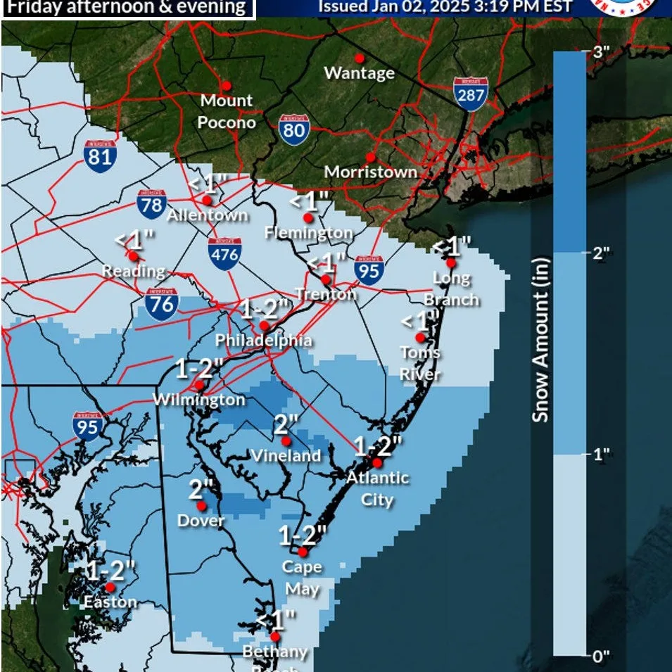
As New Jersey experiences a brief warm-up on Friday and Saturday, residents are advised to prepare for a significant drop in temperatures with cold Siberian air making its way into the region. Meteorologists indicate that this shift will bring a winter storm that is expected to cover parts of New Jersey in up to 6 inches of snow. The National Weather Service has issued warnings for this impending cold front that could result in hazardous travel conditions. Additionally, the polar vortex is influencing weather patterns in the Northeast, bringing not only colder temperatures but also the possibility of snow accumulation.
New Jersey meteorologist said, “The warm temperatures will be a short-lived enjoyment as the winter weather returns. People should stay updated on changing conditions and prepare accordingly.” Forecasts suggest that temperatures could plummet as much as 20 degrees from the highs seen during the warm-up. Residents should be particularly cautious during travel, as slippery roads and low visibility could pose substantial risks.
The winter storm warning is specifically in place for the weekend, with the possibility of heavy snowfall resulting in up to 6 inches in various areas. Predictions indicate that the snow may begin late Saturday and continue into early Sunday. Local officials urge everyone to avoid unnecessary travel during the worst parts of the storm to ensure safety.
As the impacts of climate changes are felt, this triple check on the weather reminds New Jersey residents of the unpredictability of winter storms. The National Weather Service continues to monitor the situation closely to provide updates on the snowstorm as it unfolds. Winter preparedness is key as the new season brings extreme weather shifts, reinforcing the importance of staying informed and ready.