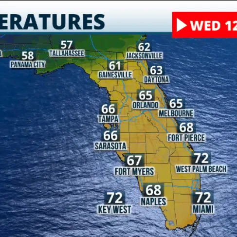
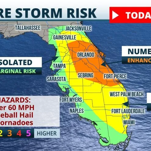
As Jacksonville braces for a significant weather change, a cold front is set to move into the area, bringing a range of impacts throughout the week. According to the Weather Authority, the timeline for the cold front’s arrival is crucial, with temperatures expected to drop significantly. Meteorologists have indicated that the onset of the cold air will also lead to increased chances of precipitation. In the wake of warmer temperatures, which averaged around 80°F over the past week, residents can expect a sharp decrease, with highs dipping to the mid-60s in some areas. The National Weather Service (NWS) issued a statement detailing the potential for storms midweek, which could bring heavy rain and strong winds. The forecast suggests sunny days ahead but with the possibility of thunderstorms. Notably, a meteorologist with Action News Jax remarked, ‘While the early part of the week is pleasant, we need to be prepared for the colder conditions and the storms that follow.’ Residents are advised to stay updated on weather alerts for safety as the cold front approaches.
Cold Front Approaching Jacksonville: What to Expect