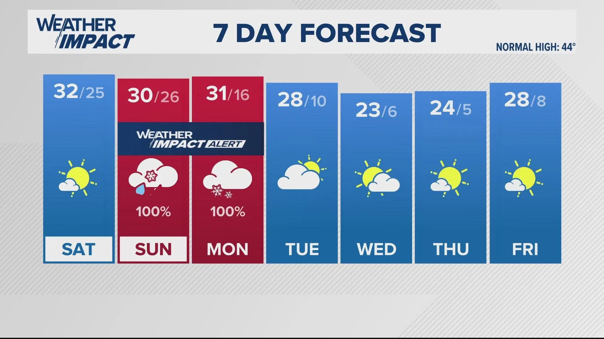
A significant winter storm is set to impact Wave Country beginning Sunday afternoon and continuing through Monday, January 5, 2025. According to the National Weather Service (NWS), the storm is expected to bring a mix of snow, sleet, and freezing rain across Louisville and surrounding areas. The storm’s onset is predicted to begin around 4 PM ET, with winter weather advisories in effect across various counties including Jefferson, Bullitt, and Oldham. With temperatures hovering around 32 degrees Fahrenheit, the mixed precipitation could create hazardous conditions on roadways, posing risks for commuters and travelers. NWS meteorologist Chris Cwik stated, “Travel during this time could be treacherous due to ice accumulation and reduced visibility.” Ice accumulations could reach up to 0.25 inches, while snow totals may reach between 1 to 3 inches, particularly on elevated surfaces and bridges. The mix of precipitation is expected to transition to all snow by early Monday morning, leading to potentially significant snowfall through the remainder of the day. Residents are advised to prepare for power outages and to stay tuned for updates as the storm develops.
Significant Winter Storm to Impact Wave Country This Weekend